SNOW TALK Begins now as we Roll into Thursday Morning:
The EURO Model from today agrees with Tonight's Evening Data from NAM/GFS as we start seeing/feeling the Effects of the Cold Front and Snow in Wyoming.
** What I am closely watching is a Low wanting to develop ahead of the Front in Colorado that could initiate some Activity before the Front dives in. BOTH Models (NAM/GFS) shows this by 5AM Thursday.
<< You can see how the Cold Front this evening sort of sped up as it is just North of Casper and Riverton. The Low could spread Snow into I-80 Corridor and maybe up to Casper; just depends on how "Moist" we are. So the Temps/Dewpoints will be closely watched when the Snow will start to fall.
THURSDAY EARLY AFTERNOON shows the Time when the Cold Front has now dropped all the way through Wyoming and now just North of I-70 into Colorado. Snow "Could" get intense during this time along and East of the Laramies so Travel may become Hazardous for Several Hours!
<< We'll have to wait and see how much snow is possible cause sometimes you see a Swinging Low lose its Steam as slides from the Pacific and drifts Eastward into NV/UT and approaches the Rockies.
* NAM shows somewhat of a Trend like this too, so its going to be interesting how the Afternoon plays out. OR, how deep is the Low to produce some Moderate Snowfall Intensity with the Upslope.
SNOW should continue through the Late Afternoon and Early Evening Hours as it will drop to "Light Snow" Intensity levels for Central/Southeastern WY. When Late Thursday Evening rolls around, Flurries should taper off past the Midnight Hour for much of Wyoming.
SO HOW MUCH SNOW IS "POSSIBLE" ??
I mentioned this last night as I use the Iowa St Meteogram & "Most" of the Time they are quite accurate with their Snow Range. Here are a few Cities I've looked at for what they're thinking:
- Casper/Laramie/Rock Springs/Sheridan/Lander: 1-4.5"
- Cheyenne/Gillette/Riverton: 1-2.5"
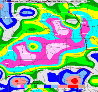
** I am not Releasing my Amounts until Wednesday Night since we have another 18-24hours for the Wednesday Data to be released but here are what the GFS/NAM Shows; This is NOT my Forecast. **
 |
| NAM Model for SOUTHEASTERN WY |
 |
| NAM Model for CENTRAL WY |
** HERE are the GFS Runs.. These go out through 120 Hours and some of the Light Snow amounts this upcoming Saturday could be included on these Amounts **
 |
| GFS Model for Central WY |
 |
| GFS Model for SOUTHEAST WY |
THOUGHTS: So we are now about 36 Hours until this Storm starts to move into WY. Wednesday Night will be the last Blog Post discussion for the Pre-Christmas Storm. I'm confident on the Timing of the Event based on the Evening Guidance AND feel that I-80 and North of Cheyenne along I-25 could be Harzardous as the spots I think the Heavier Snows could drop. We will see!


No comments:
Post a Comment