Monday, March 3, 2014

3/3: More Snow on the Way??? When will this End!?

Good late Monday Folks,

Quite a nice Afternoon on Monday.  Winds did taper off but the breeze did mix out the Atmosphere and propelled the Temperatures in the Mid-Upper 40s and Lower 50°s in Central & Southeast WY.


NAM by Tuesday 11PM
<< Now its onto the "Next" Storm, beginning early Tuesday in Western and Northern WY.  A piece of energy drops down from ID/MT and moves into WY with Cooler Air and then Precipitation.  Afternoon for Central WY looks to a Mixture of Rain/Snow with very minimal Accumulations but once the Energy increases in the colder air at Night, SNOW is possible along and East of the Laramies near Cheyenne.


Not just the NAM hinted it Tonight, the GFS Model showed signs of the same impulse in Southeastern WY.  
GFS by Tuesday 11PM


 << Northwest Flow moves through too as a Front drops down bringing that Disturbance along I-25.  Some data suggests the Moisture will run parallel along I-80 and could increase in intensity past 5PM in Southeast WY through the early Overnight Hours.


<<NOT A FORECAST, but the NAM Model shows anywhere from 1-6" is possible for Cheyenne area and near 4-8" in the Southern Laramie Range.  The Iowa St. Meteogram suggested about 3-6" for Cheyenne so you can likely see Light-Moderate Snowfall Amounts on this one with heavy bursts at times of 1"/HR in the Evening.


Here's what I am going for through the Afternoon on Tuesday for right now.  I do think my amount could be on the Lesser End, but we will see how the Morning Data takes the Storm into account for Southeast WY.  Even the Wind River Basin could stay dry on this one, but a chance is possible for many.


Sunday, March 2, 2014

3/2: Few Thoughts on this past Weekend's Storm

Good Sunday Folks,

MUCH Drier, More Sunshine, and Not as Cold.  I think much of Central and Southeastern WY dodged a bullet on this Storm; though a few spots in Lower Elevations saw some good snow like Wheatland with 10" & Torrington with 8".   Casper did see the Highest (city) amount in Central WY where 4-8" fell.  


* I know many are probably pointing the finger at the National Weather Service or us about not getting the Foot of Snow many expected or wanted.  When we Forecast an Amount for a certain city or region we say ..." you can expect anywhere from so-so to so-so inches"  Some cities are different in Elevation with different Topographical characteristics that could affect a storms progress or outcomes.  Especially in Casper we have like a 300 feet difference of Elevation from the Airport on the Plain while the City is in a Bowl and a 8000ft Mountain just a few Miles South of Downtown.  Riverton is in a Basin and so is Lander, but Lander is near the Wind River Range.
You can see the Previous Post of looking at the FINAL Snow Reports for Central & Western WY.  As it shows, if you live in Lander: " you could have seen anywhere from 8 to 12 Inches or maybe a little more"


As you probably can tell, some spots were on the Lower End of the Forecast Amounts.  I can honestly tell you this was going to be a very Difficult Forecast to predict.  Moisture was there as Weather Models were very consistent each Night for tremendous Snow along the Laramies.  


WHY Heavy Snow didn't develop a Long Duration??
1)  Dry Air: The Dry Air was really increasing as we neared the onset of Saturday Morning through the Afternoon.  I said an Arctic Air invasion will blast through the High Plains and it actually shifted a little West for much of Central WY too. Highs were only in the Lower Single-Digits.  Moisture takes a very hard time to fall at an intense rate with Cold Air (which is denser) in the Winter to punch through.  What it does, it eats it away.

2)  Upper Air Dynamics & Lifting:   I explained in a Blog Post this week about Isentropics and Upslope Flow.  This was a setup for Isentropics ~ Over-Running Moisture of rising air moving over from one air mass to another.  We had SO MUCH Moisture from CA feeding Northeast into WY with this storm.  It was still very warm in UT and as our Cold Front stalled along I-25/Central WY, our Temperatures were cold enough for Snow once it fell.  A band of moisture set up from Sweetwater/Carbon Co and streamed into Natrona County late Friday Night.  RAIN was fallen in Rawlins and mixed Precip near Rock Springs but that transition to all Snow about 50-100 Miles North.

Image Below of what Isentropic Lift is Like. 


What Favors our Pattern here in Central and especially Southeast WY is Upslope Flow.  A deep area of Moisture a new Low can form on the Lee-side (right side) of a Mountain Range can wrap around Moisture and interacts with a High Pressure..  Its a counter-clockwise flow of Wind that can cause a Heavy-Moderate snowfall rate for Mountains and cities that are tucked in along the Foothills.  THIS was a setup that was prime for Late March- April with our Snow Events here in WY.  


We do our very Best to Inform you the Potential of what can occur for you and your families if a certain event poses threat.  I am a Meteorologist and we use Model "Guidance" as a Tool to use while Forecasting while we check Upper Air Data  and other Forecasters for insights during these events.  Once it starts we Now-Cast and check Radar, Ground Truth Reports, and Water Vapor/Infrared Imagery of where the worse is occurring or could happen.  If anyone wants to blame anyone, its Mother Nature.  It takes experience for at least a few years to get a grasp of how certain events can evolve since each System is different than others in the Past.

I hope this Blog Reading is Informative and How atmospheric science is very unpredictable here in the Cowboy St. As we near March/April (more snowier months), its good to know how Weather can change in a drastic change..from Nothing to BIG or oppositely like this past weekend. 

** KEEP IN MIND, much of WY is still in a Surplus this Fall/Winter for Moisture and Snowpack which is great for upcoming Summer ** 

-MS

Saturday, March 1, 2014

3/1: SATURDAY AFTERNOON SNOW UPDATE

Before I talk about our Snow Update, have to say Happy Meteorological Spring!  Well, its not even warm enough to say it, but sure its COLD and Snowy.  Technically we all know the Astronomical Spring that starts on March 21st.


SNOWTalk:

Many are probably bummed that the Snow hasn't performed to what we hoped or forecasted for.  Bands of Snow churned in well last night at times but the Intensity couldn't last at a longer duration.  Many have seen a Lull in the Activity, but the main reason are the COLD Temperatures in the Lower Single Digits and Sub-Zero Temps:
 If you want Snow, you have to lots of moisture and semi-Cold Air.  Our "re-inforcement" shot of Cold Arctic Air really affected the Moisture as it ate into Central/Eastern WY.  High Pressure builds in and will keep us very cold Tonight.

MOISTURE still continues as we look at the Infrared Imagery in Central WY.

-- InfraRed Imagery shows the Colder cloud tops and the deeper Moisture or Light to Moderate Snowfall rates.  The Boundary has pushed a little Farther Southwest than I thought along I-80 and the best Snow bands continue for Western WY where reports of 3' of snow has fallen in the Tetons.

-  It has been very hard to get the snow to fall this afternoon to accumulate in Casper, but Drier Air from the High is much denser than the moist air trying to over-ride.


Thoughts:  Snow wants to fill in later this evening as a new Disturbance is forecasted to move through so could see some lighter amounts. WINTER STORM WARNINGS still continue for Central, Northern, and Western WY until early Sunday.  I may have over amounted, but Model Guidance trended High.  I was concerned about the Deep Arctic Air that may win out and so far, it is.


Friday, February 28, 2014

3/1: *MIDNIGHT SNOW UPDATE*

LAST Post of the Evening Folks,

For the last Few Hours I have been watching the continuous plume of Moisture evolving from UT spreading Northeast in WY.  Mainly its been Intense with deep rich color of Bright Blue cold cloud tops that shows lots of Moisture falling as Snow since we are well below Freezing.

-- Its beginning to Snow in Riverton and Rock Springs and sometimes a Mix intermittently since the Boundary has stalled along I-80.  


The BIG LOW is just off the Coast of CA still, but still sending Moisture Eastward into the NV Basin and UT.  We will begin to watch the Lows in Southern ID and UT spreading more Snow Chances for WY through the rest of Overnight and Morning Hours.  Just closely watching if any Dry Air surges in off the Plains as our "re-inforcement" shot of Colder Air can cause havoc with the Snowfall.  WE'LL SEE!  So far, forecast looks to be on par!


With the Snow we have currently, here's how much snow is possible on top of what we already have. This is the HI-RES Hourly Model showing snowfall through 12PM SATURDAY.

2/27: 7PM FRIDAY * SNOW UPDATE *

Evening Folks,

It has been an Overwhelming Day of forecasting our Snowstorm.  Moisture and Jet Stream Dynamics are increasing along our Stalled Boundary along I-25.

<< Over-Running Moisture from CO is streaming North along I-80 and in the I-25 Corridor as the Frontal Boundary is stalled.  Moisture from CA is slowly beginning to fill in.  This is why the Heavier Snows should set up perfectly for Central WY and through the Laramie Range.


<< At the Surface, here is the Radar shot at 7PM.  Moisture is funneling into Central WY and that snow is beginning to fill in on Radar SW of Casper moving Northwest.  Heavy bursts of snow are possible for several Hours.


TIMING OUT THIS STORM:


<< TONIGHT through Saturday Afternoon


<< SATURDAY Afternoon through Sunday


SO HOW MUCH SNOW Am I Forecasting?? 


Latest Hourly Weather Data shows Accumulation beginning to pick up fast late this Evening. The HI-RES Rapid Refresh (HRRR) through 7AM Saturday shows about 3-6" of Snow in the Casper area and lighter amounts elsehwhere:

Thursday, February 27, 2014

2/27: What are the Models Saying for AMOUNTS?

Good late Evening!

Lets look at all the SNOW AMOUNTS from Various Forecast Models I use as Tools to Plot my Snowmap

Evening Run from NAM HI-RES. 
<< The Snow Amount Legend is at the Top.


Evening Run from the GFS through 11PM SUNDAY


This is the Iowa St Meteogram that shows the "Range of Snow from various Models"  I use this a lot in Big Snow Events.  This is for CASPER (Airport).  Since the City is closer to the Mountain and in a Bowl, snow Amounts can be a little Higher than this.


THIS is our In-House Model Data of the RPM.  The data goes out all the way through 8AM Saturday.  The Legend on the Right is in Inches.

2/27: SNOW very Likely for WY beginning Friday

EVENING FOLKS!

Quite a Mild and 'not as breezy' Thursday for the Laramie Range with Highs in the Mid to Upper 40°s, even a 50° in Cheyenne!  

Anyone ready to get the BREAD & MILK? 
** This is how many people back in my Hometown and Region react when Snow (even Light Amounts) is in the Forecast >>>THEY SAID SNOWWWWWW **


LATEST Watches and Warnings for the Upcoming Storm:
Warnings ~PINK
Watches ~ BLUE
Advisories ~ PURPLE


Latest RADAR from Thursday 8PM:

<< Snow Showers could still be falling for Southwest WY in Uinta Co through this Evening from Evanston to Lyman. Watch for Slick Spots and some blowing snow possible.


WEATHER MODEL TALK:

 - 1ST Off, all Three Big Long Range Models I use to Forecast still show the Big Snow arriving Overnight Friday through early Saturday Afternoon.  A Frontal Boundary stalls along I-25 as a Strong Low moves into Idaho and drops Southeast through Southwest WY. On top of that, COLD Arctic Air invades in MT and the Dakota's as High Pressure builds with Temperatures in the Lower Teens or Single Digits.  The High brings an Easterly Wind Component while the Low brings South/Southwest Wind.  Moisture will move over the Cold Easterly Wind and lots of Snow is "Possible" in Central WY.  


- 2ND,  I have been closely watching the "unpredictable" NAM Model all day today.  BAD News, it Trended Wet and Moist for Central WY. I discussed Upslope and Isentropics in my Last Blog so if you are confused on them, refer back to my Wednesday's post.  The Over-Running Moisture (Isentropics) is possible for Southern WY as I think parts of Central WY and Laramies may experience an Upslope Effect (Wrap-Around) Flow of a Low. But if we look at 10,000 Feet up, it shows a Southwest flow for Central WY.    In other words, a very challenging forecast for a Moisture-Rich storm. 


BRIEF TIMELINE for Storm System #1 as we roll into the Overnight Hours and last through Friday "Early" Evening:


** ONCE We move into Late Friday and through Saturday Morning, Hazardous Travel is very likely for a good chunk of I-25 & I-80 Corridor as Moderate-Heavy Snowfall (1-2"/HR) Rates are possible. **


FRIDAY'S Forecast:
<< Once the Cold Front drops through I-90 and into the I-25 Corridor, Temperatures will drop with Snow Showers likely.  Snow Showers are possible through the late Morning and Early Afternoon so visibilities will be reduced.  


THOUGHTS:  As you see, I DID NOT release any Snow Amounts this Evening and in this Blog. Still a few Questions remain for me since will this Cold Air dry out any Moisture for Snow to dump in Central/Eastern WY?  Plus, will the Low stay on track from CA to Idaho and slide into Southwest WY?  Models slowly tend to agree with each other, but the Best thing is that we have ONE More Day on Friday to Forecast.

  *MODERATE to HEAVY Snow is Still Possible where a Winter Storm Warning/Watch is Out*

-ms


Wednesday, February 26, 2014

2/26: Wednesday's Evening Blog ~ Talking WARMTH then SNOW

Good Wednesday Evening Folks,

Thursday looks to be the "Warmth & Wind" before the Snow for Central & Eastern WY.

<< Mild & Breezy for the I-25 Corridor in the Afternoon as we'll stay Partly Cloudy.  

* MOISTURE from CA and Pacific will surge Eastward into NV/UT/ID and then impact Western WY late in the Evening with a "Light" Snow Chances.


WINTER STORM WATCHES are already out for a good chunk of Central, Northern and Western WY.  Here is what the NWS Riverton mentioned about this storm: "
A MAJOR WINTER STORM IS EXPECTED TO DEVELOP ACROSS THE AREA
THURSDAY NIGHT AND FRIDAY AND CONTINUE THROUGH SATURDAY NIGHT. THE
COMBINATION OF THREE STORMS SYSTEMS ARE EXPECTED TO COMBINE TO
FORM A HIGH IMPACT LATE WINTER STORM ACROSS THE AREA. THE WEST
WILL BE IMPACTED FIRST AS THE FIRST WEATHER DISTURBANCE MOVES IN
FROM THE WEST THURSDAY NIGHT AND LASTS INTO FRIDAY. AT THE SAME
TIME...AN ARCTIC COLD FRONT WILL MOVE SOUTH INTO FAR NORTHERN
WYOMING LATE THURSDAY NIGHT AND WORK SOUTH INTO CENTRAL WYOMING
DURING THE DAY FRIDAY. SNOW WILL DEVELOP BEHIND THIS SYSTEM ALSO.
A THIRD...MOIST AND POTENT STORM SYSTEM FRIDAY NIGHT AND SATURDAY
WILL COMBINE WITH THIS ARCTIC AIR TO PRODUCE A POTENTIALLY VERY
MAJOR STORM SYSTEM ACROSS CENTRAL WYOMING WITH SNOW CONTINUING
ELSEWHERE.


I am not Showing the Model Runs in this Blog Post this evening, but what I want to tell you is that this storm isn't showing signs of a classic Upslope Flow event.  This is a setup that shows Over-Running of moisture in a Zone or Band.  We call these Baroclinic Zones as Moisture can stream from UT/CO and surges Northward into WY. This zone can cause rising air to lift over Colder Air and surge Moisture ~ Isentropic Upglide.   (IMAGE BELOW)


- 3 of the 4 Weather Models (GFS/EURO/CANADIAN) still shows Moderate to Heavy Snow for Central and Eastern WY along the Laramies from Overnight Friday through Early Afternoon Saturday.  

- However, there is one Outlier; the NAM Model.  This shows much Drier Air as High Pressure eats away the Moisture, but only shows "Lighter Snow".  
  ** I will closely watch the Trends of each Model, any Fluctuations of themselves and any consistency between them through Friday Morning once the 1st Wave of Moisture spills in.  **


MODEL SNOW AMOUNTS:  **NOT A FORECAST **
This is the Canadian Model through 5AM Sunday:

-Casper: 6-12"
-Laramie Range: 12-16"
- Rest of Central WY: Anywhere from 2-6"

* Canadian Model has been fairly consistent with this Storm so we will closely see what it wants to spit out from Late Thursday through Sunday


<< This is the GFS Model Amount through 5AM Sunday.

Central WY: Over a Foot in Lower Elevations  along the I-25 Corridor

Laramie Range: 18"+

** Remember, the GFS has been very aggressive with this Storm for Central WY from Casper to Cheyenne along the Laramies.


METEOGRAM:   Here is the Iowa St Meteogram that shows Snow Amounts from different Weather Models.
< Casper's snow varies due to the NAM Model being Low, as the GFS shows the Higher Amounts.


Other Cities for Forecast Amounts via Meteogram ^
Lander: 3-7"
Sheridan: 3-6"
Gillette/Cheyenne: 2-4"
 Rock Springs/Laramie: 1-3"
Riverton: .5-1.5"


THOUGHTS:  As I looked at the Upper Atmosphere today about 10,000 Feet, you can tell where the Winds will be blowing from.  Its not a classic "dumping" of Snow for WY with the Upslope flow, but we could likely see that Isentropic (Southwest Flow) Lift.  Besides that, the Threat still exists for Moderate to Heavy Snows for Central & Southeastern WY along the Laramie Range.  A FOOT of Snow is still possible but once we head into Late Thursday and Early Friday, that is when we will have a better grasp of who can see how much.

Tuesday, February 25, 2014

2/25: One SNOW System down, TWO more to go in WY

Tuesday's System caused a few Headaches in Central & Southeastern WY.  Quick burst of snow moved through Late Morning and cleared up late this Afternoon as bulk of the Snow will fall in the Southeast.  Snow should taper off by 8PM later this Evening near Cheyenne.  

SNOW REPORTS SO FAR as of 6PM:
 * When all is said and done with by Late this Evening, could expect another Inch or Two in the Southeast in a few Isolated spots from the Heavier Bands.


COLD EVENING once again for much of WY as High Pressure brings Arctic Air through the Overnight. Bundle Up if your going out and bring in the Pets.


MID-WEEK:
 *  Wednesday and Thursday (Day) looks to be fairly tranquil in our Weather Pattern across WY as we will stay Dry and Above Avg. for Temperatures. Yes, the Wind will stick around so watch for the Blowing Snow on the Highways & Interstates.  When THURSDAY EVENING rolls around, that is when we'll see our Next Ssytem slide in from California. By the Way, this is Plentiful Moisture for Drought-Stricken CA! 

* You can tell how these Lows or Systems are lining off the Pacific and moving through the Basins.  

* A Cold Front will sag Late Thursday through Friday along the I-25 Corridor as the High stays put meaning the Moisture can't move East into the Dakota's.  Upslope Flow is likely with the Northeast/East wind flow can pile up the Snow in the Mountains.


FRIDAY:
  I think there will be several periods of Light to Moderate SNOW for much of Central & Eastern WY.  Can't forget how the I-80 Corridor will be impacted early in the day too. The Front stalls with some Upper Level Dynamic from the Jet Stream and forcing of some Upslope.  As we head into Late Friday, Our NEXT round of Moisture funnels off the Coast of CA into the Basins again.


SATURDAY:  This is when the Conditions may become very Hazardous for much of WY.  A very complex and dynamic storm will feed into WY where Moderate to Heavy Snow is possible for Central/S'Eastern WY as early as in the Morning.  A re-inforcement shot of Cold Air with a Surface dropping down will interact with the Moisture from the West.  A strong Low will form in ID and a Trough could drape along Southern WY.   Dynamics look to in-paced for a long duration of Big Snow from the Morning to Evening. A 2nd surge on late Saturday could funnel in. We have to watch closely on the Cold Air on the back side and where the Boundary is in placed. Colder Temps than forecast can sometimes Dry out some of the Atmosphere.


EARLY THOUGHTS:  Since some of the SNOW Amount Models are overlapping Tuesday's Storm for our upcoming late Week-Weekend Snows, hard to get a grasp of just How Much is still possible. I do think some spots of the Lower Elevations can likely see Double-Digit Amounts from Friday through Sunday.  This will likely be the 1st Storm of 2014 to impact Central WY pretty well with Snow Amounts.  Advisories are very likely so its very crucial to stay up with this storm each Day.  Any slight deviation of Moisture, Track and Colder Air will impact who can see what or How Much.

Also to Note is if you can see, I used the GFS Model Data on this Storm.  The Three Long Range Guidance Models (EURO/GFS/CANADIAN) do show these storms very consistent with one another.  We will closely watch IF they stay in that same pattern or if 'one' Model shows something different. 

-ms

Monday, February 24, 2014

2/24: More SNOW, Unsettled Weather & 3 Storms in One Week???

Evening Folks!

This is a very Busy and Unsettled Week to start off Late February and into March.  Many have heard the saying "March can either come in like a Lamb/Lion and leave out as a Lamb/Lion"   Well IF it comes in like a Lion (unpleasant, stormy, unsettled) it may leave out like a Lamb (tranquil/quiet/pleasant)

As I look Long-Range and into March, I choose the LION to start out a Month... Its looking very Unsettled and Stormy with Snow Chances all this Week and into the Weekend. I'll be breaking down each one this Evening as I mentioned tonight during our 5 & 6 Shows.  


HERE is the 7-Day Forecast for Casper this Week.  Though I didn't post Riverton or Cheyenne, I do think Temperatures will stay Cool on Tuesday, Seasonal Wednesday/Thursday and then COLD again late Week and Weekend.  ~ Those are just Temperatures.  SNOW is something different as we have 3 Systems that will affect our State. 


SYSTEM #1)   Along our Stalled Frontal Boundary over I-25 and Central WY, a piece of energy will carve out of the Bitteroots of MT/ID and drop Southeast into WY as by Tuesday Morning and lasting through Early Evening in the Laramies.  LATEST Data shows a swath of Light Snow Amounts all across Central WY in the Lower Elevations & about 3-6" in Laramies or so.


SYSTEM #2)  Now all of WY will catch a break on Wednesday as we'll be between a Western Ridge & an Eastern Trough.  This means, dry and breezy weather increases and lasting through Thursday Afternoon.  Now much of WY stays dry on Thursday but our Next piece of Energy will move in after Moisture from CA/NV drifts East in the Western Basins.  As a Surface High builds back into the Dakota's, the Boundary will shift West into WY.  The Moisture moving in from the West to the East  will interact with the High.  Dynamics and Upper Level Forcing will create more SNOW for much of WY late Thursday and into Friday

<< ALL Long-Range Weather Models show this from this Mornings Run and will be closely watching the very latest data rolling in beginning Tonight. 

** I do think the Potential of Light to Moderate Snowfall is possible for the Lower Elevations in the Basins and along the I-25 Corridor.


SYSTEM #3)  OKAY, so as we lead into the Weekend, our Friday System will erode away but a "Newer" piece of energy from the Pacific will usher in more Moisture as that Frontal Boundary will stay Put along the Laramies and I-25 Corridor.  THIS batch of Moisture looks to pack a little more energy than System #2 as it carves out of CA once again.  Moisture streams a Low of 1004mb in the West with Upslope potential in the Laramies.

<< Again to Note, ALL THREE Weather Models make the similarities of the Friday>Saturday System of the Timing and Intensity.   

* Wherever that Boundary stalls, sets up a good placement of the Heavier Moisture. So far, I-25 Corridor looks prime for Moderate-Heavy Snowfall potential.


EARLY THOUGHTS:  Fairly certain Tuesday's Storm will be Light with maybe a burst or two of Moderate Snowfall rates (1"HR) once it moves through BUT  System #2 & 3 are NOT set in-stone yet.  Lots of Upper Level Energy/Dynamics/Moisture can make this an unsettled late week in WY with the Potential of Heavier Snow Rates (1.5-2"/HR).  I AM NOT Throwing out Amounts, but I do think a Double-Digit Snowfall Amount is possible in some spots in the Lower Elevations.  Will keep you posted through the Week! 

Tuesday, February 11, 2014

2/11: More SNOW & WIND ~ Typical WY February Flow

Haven't post a Blog in a while, but been a crazy Surplus of Snow for parts of Central WY.   Casper has actually seen over 15" above average so far of Snow at the Airport.  

But lets get to WEDNESDAY.  A Busy Afternoon on tap from Mother Nature as parts of Central & Southeastern WY will be ahead of our next Trough developing East of the Rockies. 

HIGH WINDS WARNINGS have been issued along the Wind Prone Corridors.  Wind Gusts of 50-70mph are possible at times through the Day so safe travels and keep an eye on the strong Cross-Winds. 
** This Windy Pattern should persist through the Rest of the Week in the same spots.  **


Now onto the SNOWY West.  After over a Foot fell in the Western Valleys and anywhere from 2-4' in parts of the Mountains this past weekend, MORE is on its way beginning as early as Wednesday Morning.  However, their may be a few breaks in the Intensity during the day.  Snow looks to last all the way through late Afternoon Thursday!  A prolonged Heavy Snow event where a Foot is expected in the Valleys & from a Foot to under Three Feet is possible in the Mountains. Plus, can't forget that the Sierra's and Snowys will experience over a Foot for them.

* WINTER STORM WARNINGS ~ Pink
* WINTER WEATHER ADVISORIES ~ Purple
* WINTER STORM WATCHES ~ Blue


** SNOW FORECASTS **
- These are NOT my Forecasts, just Guidance or Tools I use to Forecast.  The NAM shows an overwhelming amount of 18"+ in the Mountains early Saturday as a NEW System moves in by Friday Night.


Through 5AM THURSDAY, our In-House RPM Model shows some Mountain Tops getting nearly 30", so conditions should deteriorate by late morning on Wednesday out West.

Monday, January 27, 2014

1/27: Mid-Late Week MESS

Good Late Evening Folks,

BUNDLE UP if you haven't done so yet for the Overnight.  High Pressure builds as the Arctic Air mass invades for an Evening in the Plains and Rockies:

As for TUESDAY, I think we'll stay Dry & Cool, but the Southwest flow will increase through the Afternoon. Safe Travels along the Wind Prone Corridors along I-80 and I-25 as the Snow will be blowing.
 

Mid-Week Confusion is the Best way to put it as we roll into WEDNESDAY.  Snow is likely for a good chunk of Western WY based on Evening Model Guidance.  This is our New Storm coming on-shore from the Pacific Northwest as lots of Moisture and Dynamics are in placed.  Over-Running Moisture will pour in with Several Inches of Snow and Feet in the Mountains and Western Valleys.  Central WY looks to stay Blustery/Dry through the Afternoon, but won't be surprised if we see a Mix bag of Precip when Evening rolls around past 5PM. 
(IMAGES BELOW)
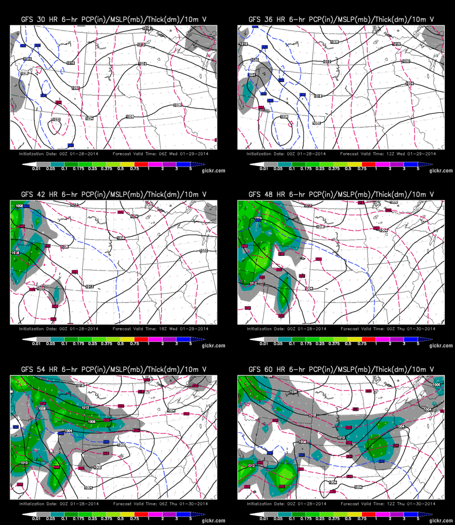
Your animation


Evening Model Guidance shows a  MOIST Flow of Snow for Western WY on Wednesday, but it'll take a hard time for that Moisture to spill East of the Divide since the Wind Energy can tear apart the Storm.


THURSDAY/FRIDAY:  Not really going in-depth with these two days, BUT something was very Interesting as I forecasted this Afternoon and Evening.  What you want as a Meteorologist are many "ingredients" that come Together (Lift, Moisture, Dynamics, Forcing & COLD Air)  Monday Morning Data suggested lots of Moisture, Upslope Lifting and Forcing of Air Masses with a Stalled Boundary in placed along the I-70/80 Corridors.  Moderate-Heavy Snow showed up in Central WY through Casper/Cheyenne and along I-80. 

HOWEVER, Evening Weather Data tonight showed all those Ingredients about 75-100 Miles than originally placed.  What does this Mean?  DRIER and Slight chance of Snow in Central/Southeast WY while Utah/Colorado gets the bulk of the Moisture along I-70.  This storm does show signs of ugliness as a tight Low of 996/992mb is Possible with Strong Upslope. Anything below 1000mb is something to grow concern.

THOUGHTS:  If you still want a big Snow, don't be "boy who cry wolf" yet.  Its still possible as Model Guidance can fluctuate back and forth.  I look at Four Weather Models (NAM/EURO/GFS/CANADIAN) each day and all the Models can show similarities or differences.  Each Storm is different and the Storm Track can alter or adjust its course the Night Before.  Why this field is a Forecast... WE DO NOT KNOW for a fact once the Storm has Arrived.  This Season, its been a surprised so far as Storms have Stalled and Strengthened ontop of Central WY.